![]()
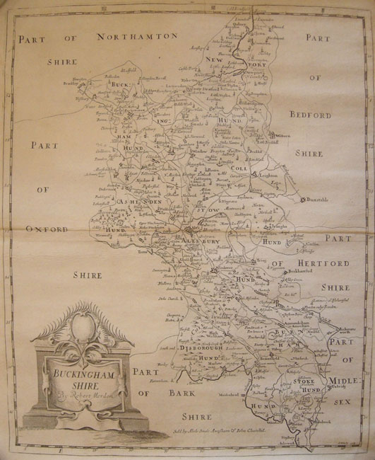
Robert Morden
BUCKINGHAMSHIRE
Copper Engraved map uncoloured as issued, First Edition,Ornamental title cartouche. London 1695
16 5/16 x 13 9/16 (41.4 x 34.5 cm)
Ref. RStC 3/DNN/ da.anno> AAL PRICE CODE B
Published in the new 1695 edition of William Camden’s Britannia by Dr. Edmund Gibson of Oxford University, & Bishop of Lincoln. Printed by F. Collins for Abel Swalle at the West end of St. Paul's Church yard and for Awnsham and John Churchil[sic] at the Black Swan in Paternoster Row, engraved by S. Nicholls. Illustrated with a new series of maps by Robt. Morden.
The draft of the maps being sent to some of the most knowing Gentlemen in each County; with a request to supply the defects, rectified the positions, and correct the false spellings.” Gibson The maps are noted for their clear detail and attractive cartouches. Clearly delineated are roads, towns, estates, forests.Another feature of these late seventeeth century maps that is of particular interest is that Morden's measurement of longitude were the first maps to be based on a prime meridian through St. Paul's Cathedral in London,
Home | Contact | Location | Links | Antique Prints | Fine Art | Antique Maps | Omnium Gatherum | Specialty Services